The Chatham Islands |
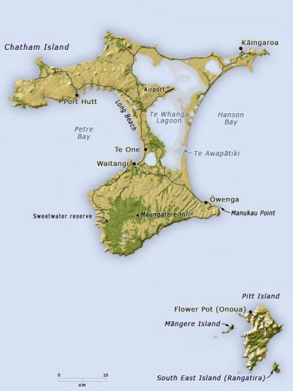 Introduction: This map of the Chatham Islands has been adapted ever so slightly from one on the Te Ara / Encyclopedia of New Zealand website (for which I worked from 2010 to 2013). It shows how the two main islands are Chatham Island and, to its south-east, Pitt Island. The roads on both islands are marked, and the map also shows how the north-eastern portion of Chatham Island is dominated by the Te Whanga Lagoon. The total area of the Chatham Islands is 966 square kilometres / 373 square miles. |