Climbing Kings Peak
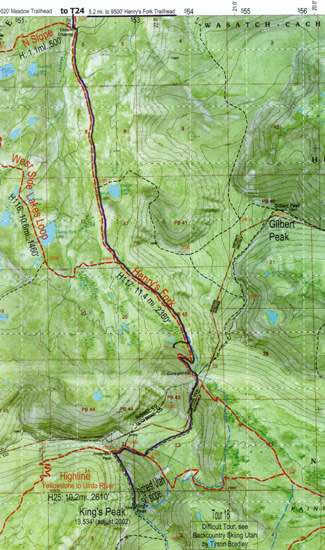
This map shows part of the route Eric and I took to climb Kings Peak. Not shown on the map is the vast bulk of the 5 mile / 8 kilometre section of the Henry's Fork trail from the trailhead to Elkhorn Crossing, where we crossed the Henry's Fork River. We then continued south to a small tarn near Gunsight Pass, where we camped. The following morning (i.e., on Tuesday, 31 August 2010), we climbed to the top of Gunsight Pass and then took a shortcut. We did not descend into Painter Basin (which, somewhat surprisingly, many people do). Instead, we sidled round the rocky slopes an unnamed 13,103-foot peak to get to Anderson Pass. We then headed south again, clambering up, over, and around talus boulders to reach the summit of Kings Peak.
To get back to the Henry's Fork trailhead, we simply re-traced our steps.