The Larapinta Trail, 2023 |
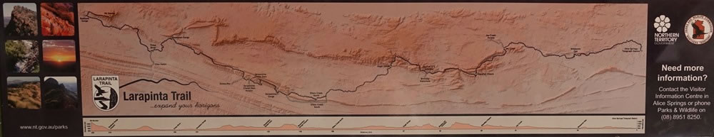 Introduction: This is a photograph of a map that was on one of the many information signs that we came across. It is of the whole of Larapinta Trail, which goes from Alice Springs (at the right-hand edge of the picture) along the spine of the West MacDonnell mountain ranges to Redbank Gorge and Mt Sonder, which are at the western end of the 230-kilometre trail (and which are on the left-hand edge of the map). |