Climbing Mt Woodroffe |
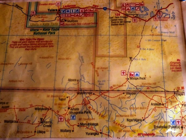 This is a photograph of a map in SEIT’s camp near the foot of Mt Woodroffe. It shows the route we took to get to the mountain. Initially, we drove east from Yulara (the Ayers Rock resort village) for 85 kilometres / 52 miles to Curtin Springs Cattle Station. After an additional 12 kilometres / 7.5 miles, we left the sealed road (i.e., we left the Lasseter Highway) and turned right – south – onto Mulga Park Road. After 67 kilometres / 41 miles, we stopped near the Mulga Park Station homestead for morning tea. A few kilometres later, we turned off Mulga Park Road, branching right onto a small track that took us to the South Australian border. We then continued making our way south on small bush roads to SEIT’s camp at Ngarutjara – the base for our Woodroffe climb. |