Climbing Black Mesa, Oklahoma |
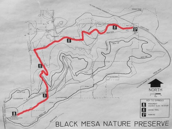 This is a photograph of a map of the Black Mesa Nature Preserve that was on the notice-board above the box that contained the hikers’ intentions’ register. It shows the route I took to get to the summit and back (which I’ve highlighted in red). The distance from the parking area to the Black Mesa summit monument is 4.2 miles / 6.75 kilometres (making the total hike a round trip of 8.4 miles / 13.5 kilometres), and there is an overall elevation gain of 654 feet / 199 metres. |