Climbing Mt Greylock |
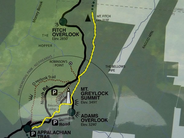 At the Visitor Center I photographed this map. It helped me to decide what to do: I would drive up Rockwell Road to a car park about a mile south-west of the summit of Mt Greylock, leave my rental car there, and hike to the top of the mountain. However, because Mt Fitch is immediately north of Mt Greylock and because Fitch is my daughter-in-laws surname, I decided Id also hike to the top of Mt Fitch. As the whole hike I would be doing was on the Appalachian Trail, the plan was doubly appealing to me and the out-and-back route I took is marked in yellow on this map. |