Climbing Mauna Kea |
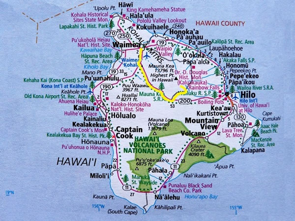 The route we took to get to the Mauna Kea Visitor Center, which is also known as the Ellison Onizuka Visitor Center and which is where Eric and I began our Mauna Kea hike, is marked in yellow on this map. From Waimea, we drove south on the Mamalahoa Highway (Hawaiian state route 190), then south-east – first on the Saddle Road and then on the new Daniel K. Inouye Highway (Hawaiian state route 200) – before turning left onto the Mauna Kea access road and heading north for little more than 6 miles / 10 kilometres. The drive from Waimea to the Mauna Kea Visitor Center – a total distance of about 38 miles / 61 kilometres – took us about an hour and twenty minutes. Why so long? Well, not only was it pitch dark, but we also climbed from about 2,500 feet / 760 metres above sea-level to 9,200 feet / 2,800 metres. (On the map I’ve also marked roughly where Rosemary and Tom Fitch live: it’s the small red “x” slightly to the left of the second “C” in the township named Captain Cook.) |