The Routeburn Track |
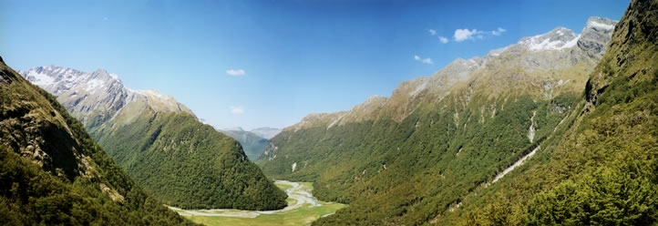 While I was standing on the rocky outcrop beneath the Routeburn Falls Hut, I took five portrait-style photographs which Ive both digitised and photostitched together to make this panoramic picture. The rocky pinnacle near the left-hand edge of the picture is Mt Momus (2,148 metres / 7,047 feet), which is at the southern end of a ridge linking Mt Somnus and Mt Momus. The Routeburn Flats are in the centre of the picture; while the large slip that was caused by heavy rain in January 1994 can be seen as a dramatic diagonal slash through the bush and trees near the right-hand edge of the panorama. |