Spruce Knob, West Virginia |
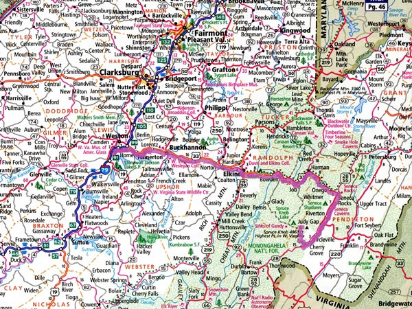 On Thursday morning, 5 November 2015, I drove north-east on US Interstate highway 79 from Charleston, West Virginia (which is off the bottom left-hand corner of this map). Near Weston, I turned right at exit 99, off I-79 and onto US federal highway 33, and I travelled east on it as far as Seneca Rocks. US-33 then turns south, and I continued following it for another ten miles / sixteen kilometres, before turning right and driving up Briery Gap Road, Forest Road 112, and Forest Road 104 to a parking lot near the summit of Spruce Knob. |