 |
NIGEL ROBERTS Highlights of the Larpinta Trail |
|
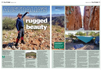
My Canberra-based climbing partner and I were in the Northern Territory on a quest to climb the “Aussie Eight” – the highest peak in each of Australia’s six states and two mainland territories. After sleeping in swags under the stars on a dry creek bed, we rose at 5:00am and six-and-a-half hours later reached the summit of the Mt Zeil. From the top of Australia’s highest mountain west of the Great Dividing Range, I looked out across the Northern Territory’s harsh and forbidding – but also enchanting and enticing – semi-desert landscape, and thought “I’ve got to come back here.” Ten years later, I found a way to do so. Californian friends, Bob and Peggy, let my wife, Heather, and me know they were going to be in Western Australia to observe the April 2023 total eclipse of the sun. Would it be possible, they wondered, for the four of us to get together afterwards? Fortuitously, Heather and I were intending to visit family members in South Australia in May 2023, so I suggested we meet in Alice Springs and walk parts of the Larapinta Trail. It is one of Australia’s pre-eminent hiking routes, and links Alice Springs (the Northern Territory’s second-largest city) in the east with Mt Sonder at its western end. The Larapinta Trail traverses the entire length of the West MacDonnell mountain range and is 230 kilometres long. It’s divided into 12 sections, and it takes about as many days (or more) to walk the whole trail. It’s a very tough hike: the most practical time for hiking it is from April till September when the days are, with luck, not excessively hot and the nights are cold. What is more, the trail’s food storage sites are several days apart, and – given that you are in Australia’s semi-desert red centre – hikers need to carry a lot of water. As a result, Bob, Peggy, Heather, and I opted to do a guided walk. Based at a private camp for five nights, we spent six days exploring highlights of the Larapinta Trail.
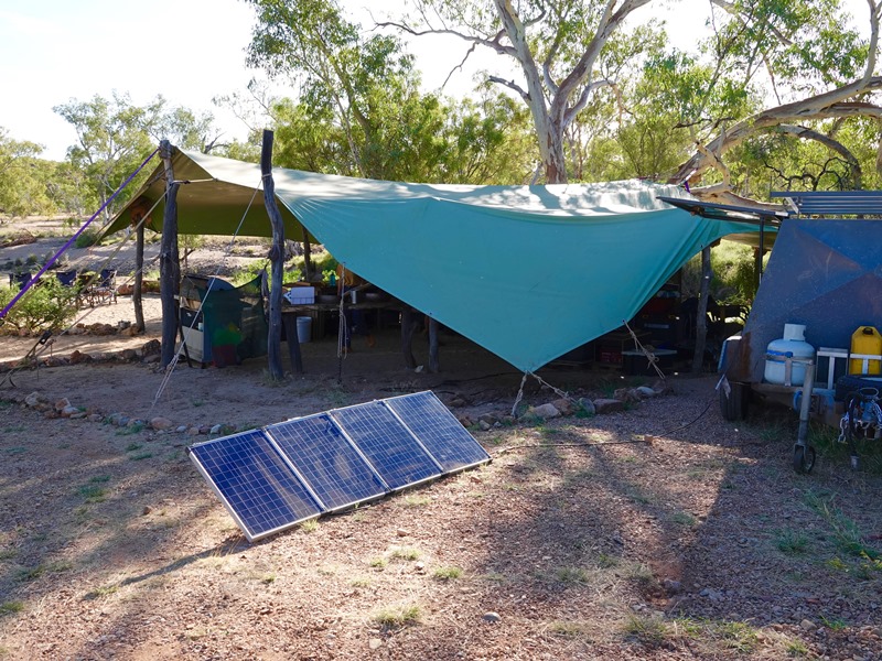
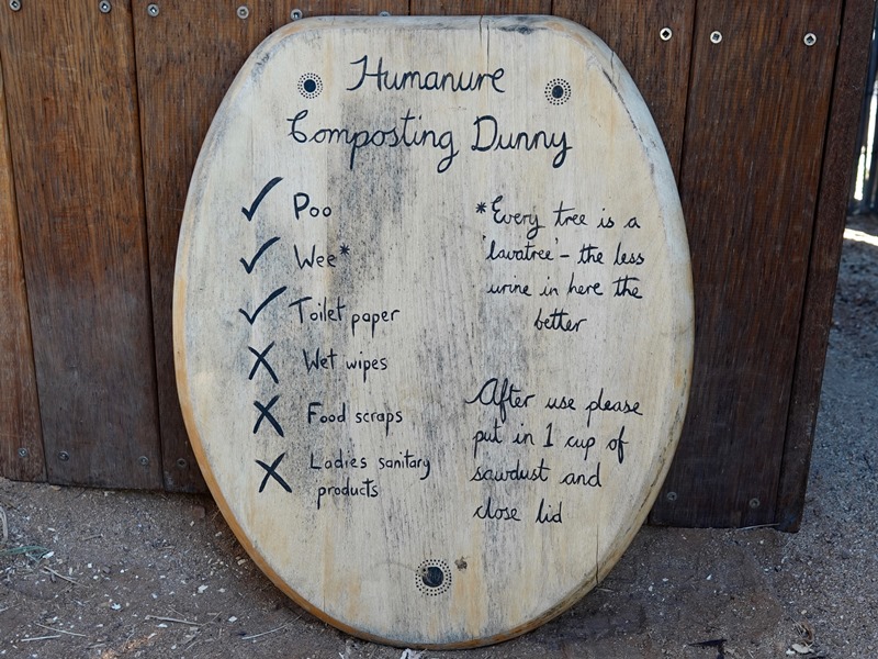
We were very happy with our choice: the guides were knowledgeable, thoughtful, and helpful, as well as being very good cooks; we were not glamping, but our tents were large and our camp beds comfortable; and the camp’s solar water heating system and composting toilets were perfectly adequate and environmentally friendly.
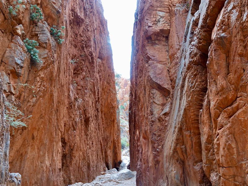
Over millions of years, massive geological forces thrust up and folded huge slabs of quartzite in central Australia, and today those slabs are visible as spectacular gorges and chasms. Twenty-five minutes after we’d been collected from our Alice Springs hotel, we stopped for a briefing at Simpson’s Gap. It’s where the Roe Creek has – over aeons – eroded the area’s quartzite cliffs and created a narrow cleft in the West MacDonnell mountains. Even more spectacular, though, was the site of our final day’s hike: Standley Chasm. It’s a billion-year-old geological wonder. The local Aborigines call it Angkerle Atwatye – i.e., “the place where water moves between”, which is an almost poetic summary of the way water has flowed over thousands of thousands of years through cracks in the rocks and slowly eroded the softer surfaces.
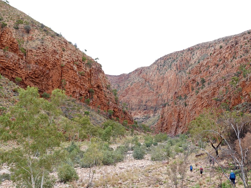
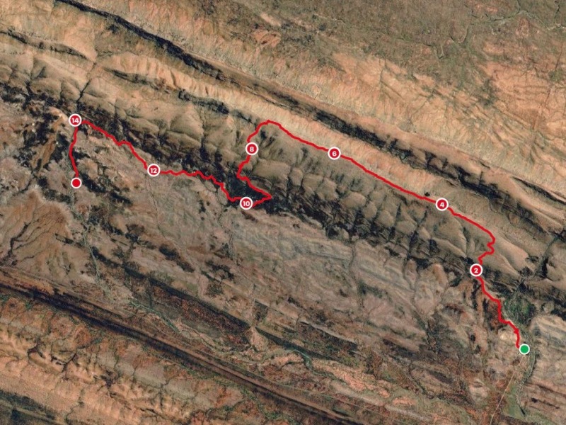
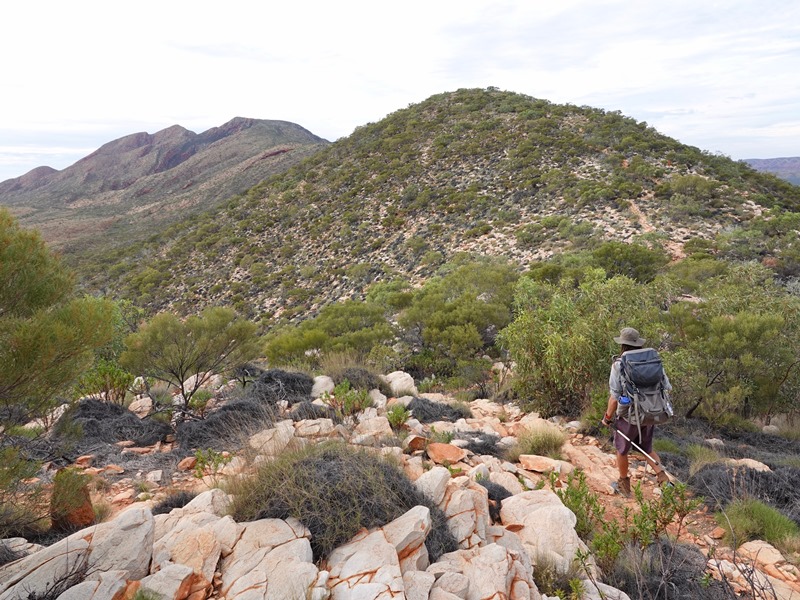
Over the course of six days, we went on six hikes. The two longest were 16 kilometres each; three of the walks were about 11 kilometres apiece; and our shortest hike was roughly four kilometres long. Our first day’s walk was a wonderful introduction to the Larapinta Trail. Setting off from the Ormiston Gorge campsite, we went on an anti-clockwise loop that took us up to the rim of the Ormiston Pound, down into and across the western edge of the Pound, and to the Ormiston Gorge, where we had to wade through the thigh-deep Ormiston Creek before we were able to return to our starting point.
The Pound gets its name from an old English term for an animal enclosure, and it resembles a large (but comparatively shallow) meteorite crater. What I didn’t realise at the time was that on our fifth day we’d get to see (albeit from a distance of 40 kilometres) an actual meteorite crater: the Gosse Bluff crater, which was formed when a comet collided with the earth 142.5 million years ago. Unlike New Zealand, Australia has 30 or so confirmed meteorite craters, and I was really pleased to be able to see one of them. In terms of time, our longest hike was our second day, when we spent nine hours walking Section 8 of the Larapinta Trail and then, afterwards, out to the road end.
We started at the Serpentine Gorge carpark. For the first 40 minutes, we headed through the gently undulating foothills of the Heavitree range before we began zig-zagging our way up the considerably steeper slopes on the southern side of the range. Once on top, though, we had a very pleasant six-kilometre hike west along the range’s summit ridge line as far as Counts Point, where I was thrilled to see Mt Sonder on the distant horizon.
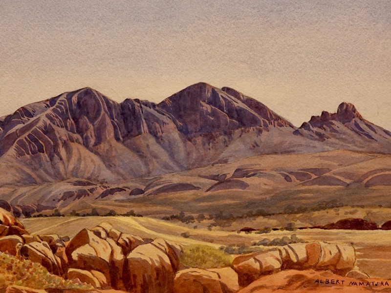
After a picnic lunch in what little shade we could find, we climbed down off the Heavitree range and continued making our way west towards the site of the former Serpentine Chalet, a 1960s tourist venture that had failed because of – surprise, surprise – a lack of water. There were two main reasons why I was thrilled to see Mt Sonder on Day 2. First, I’d seen it ten years previously from the summit of Mt Zeil. Apart from Uluru (ex Ayres Rock) and Kata Tjuta (formerly known as the Olgas), Mt Sonder is the best-known mountain in the Northern Territory. That’s largely because it was frequently painted by Albert Namatjiri, one of Australia’s foremost Aboriginal artists. It was also painted by Albert’s son, Oskar.
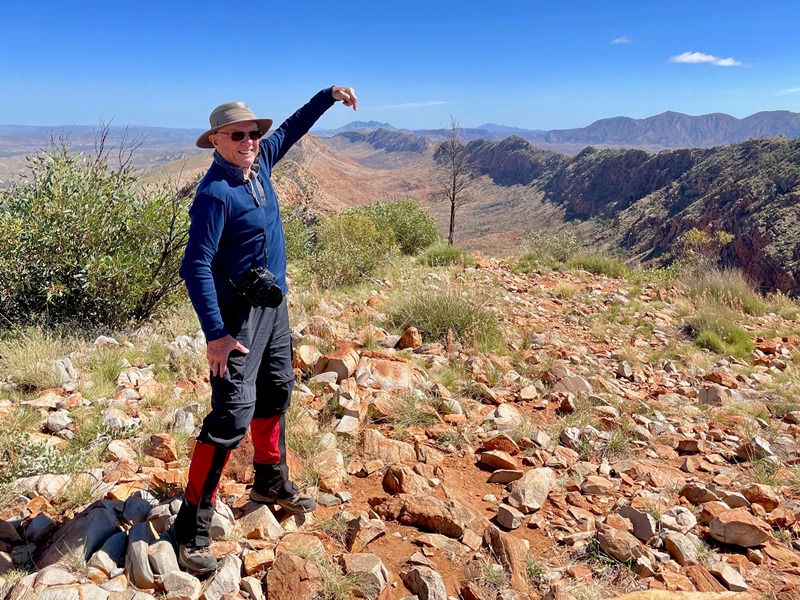
Second, there was a possibility that we would be climbing Mt Sonder on Day 5 of our six-day Larapinta Trail adventure – and, I’m delighted to report, four of us did just that. The 16-kilometre out-and-back route from the Redbank Gorge carpark to the summit of Mt Sonder is the 12th and final section of the Larapinta Trail. The track is described as “rough with long steep sections” requiring “bushwalking experience and a good level of fitness.” There’s a 700-metre vertical ascent, softened only by the stunning scenery.
Mt Sonder has two summits. The one that we climbed, the highest point of the Larapinta Trail, was separated by a small gorge and steep red cliffs from another summit that’s a few metres higher. However, only members of the Western Aranda (or Arrernte) Aboriginal nation may ascend the mountain’s true summit. It’s an example of the growing awareness of – and cultural sensitivity to – the fact that for tens of thousands of years Australia was home only to the continent’s indigenous Aboriginal inhabitants. It’s an awareness we encountered again after our six-day Larapinta Trail hiking holiday was over. Bob and Peggy flew back to San Francisco, while Heather and I headed (as we’d originally intended to do) to South Australia. As our plane prepared to take off from Alice Springs, the cabin crew’s announcements and safety instructions began with the following words: “We acknowledge the Aboriginal and Torres Strait Islander traditional custodians of the land on which we work, live and fly. We pay respect to elders past, present and emerging.” After six days on the Larapinta Trail – in the heart of Western Aranda country – we could only say “Amen” to that.* * * * * * * * * * * * * * * * * * * * * * * * * * * * * * Nigel Roberts is an emeritus professor of political science at Te Herenga Waka / the Victoria University of Wellington. Detailed illustrated accounts of his travels can be found on his website (www.nigel-roberts.info). * * * * * This article was published in The Post, Wellington's daily paper, as well as in other newspapers in the Stuff stable, on Monday, April 7, 2025. (The headline The Post gave the article was "Australia's Rugged Beauty".) * * * * * |
||