Climbing Boundary Peak |
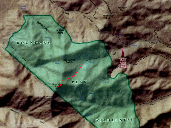 This photograph of the map on the Boundary Peak trailhead noticeboard is the best way I’ve found of showing what we did. From the trailhead, we hiked west on what was initially a clear path. After about an hour we veered left. We did not go up to the Trail Canyon saddle. Instead, we followed the route I’ve roughly traced out in red on the map, which took us into the basin that’s below the word ‘PEAK’. We then zig-zagged / switchbacked our way up onto Boundary Peak’s north ridge, before heading south and then, finally, south-west along the mountain’s north-east ridgeline to the summit. |