Climbing Humphreys Peak
Previous | Thumbnails | Next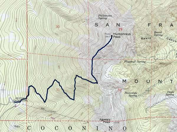
This photograph (which is of a part of the USGS’s map of the Humphreys Peak area) gives a rough indication of the route we took to climb Humphreys Peak. After a five-minute walk across a meadow, hikers enter the Coconino National Forest and then climb – via a series of long switchbacks (or zig-zags) – to the rim of the former San Francisco volcano, which is at roughly 12,000 feet / 3,650 metres above sea-level. Climbers then turn north and, by and large, follow the crater rim ridge-line to the summit of the peak.