Climbing Mt Mansfield |
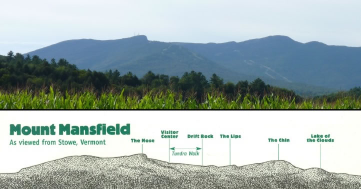 After reaching Stowe and turning left off VT-100 onto VT-108, one can get this view. The upper half of this picture is a photograph I took of Mt Mansfield; the bottom half is from a leaflet entitled The Tundra Walk, and it shows why, to quote from Joe Glickman and Nels Akerlunds book, To the Top: Reaching for Americas 50 State Summits, Viewed from the east, Mansfields two-mile-long profile purportedly looks like a face (especially if youve been drinking heavily)! |