Sassafras Mountain, South Carolina |
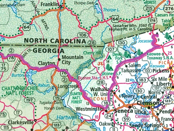 On Wednesday morning, 28 October 2015, I set out from Blairsville and drove east on US federal highway 76 to the Georgia / South Carolina state line. I then continued driving on US-76 until I reached Westminster, South Carolina, when I turned left and drove north on South Carolina state highway 183 until it intersected with South Carolina state highway 11, which I followed for 23 miles / 37 kilometres prior to turning left onto US federal highway 178. I then travelled six miles / ten kilometres on US-178 before turning right onto the F. Van Clayton Highway which is, in reality, only a narrow mountain road and I drove up it for 4.7 miles / 7.5 kilometres to the car park thats below the summit of Sassafras Mountain. |